There is joy in recollecting. Memories abound, including campgrounds that look like this.
Matauri Bay campground
Mahinepua Peninsula walk
Matai Bay DOC site
Cape Reinga, at the tip top of the North Island
The collision of two great oceans, to the west the Tasman Sea and to the east the Pacific.
Te Paki sand dunes
The Mangaweka campground, sitting right on the Rangitikei River, which runs through an enormous clay canyon.
Gore Bay
Tongariro National Park
We spent an immensely rewarding near-week here and it still wasn't enough to walk all the trails. What a magnificent national park (hand over heart)...
Kawhia Hot Water Beach
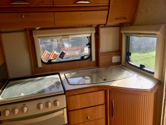
The surprisingly efficient caravan kitchen
Pukeko
Walking bridge from the Raglan campground into town
That sums up perfectly our experience in NZ. It is our good fortune to spent the better part of three seasons here, and for a third time the country and its citizens have welcomed us with grace and smiles, generosity of spirit, and good humor. Taking a look back...
We began on Great Barrier Island
All craggy shoreline, water water everywhere, and rough metal roads in a rental car.
This view from our room at Trillium Lodge...and the stars.
Back to the North Island, where we picked up the caravan for a tour of the unexplored (by us) parts north of Auckland. A few of our favorite things...
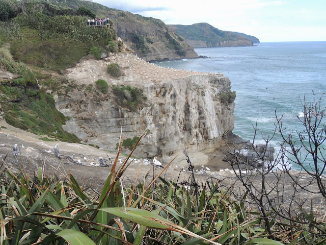
The gannet colony near Muriwai
Fried haloumi (on anything)
Engaging signs
Muriwai Beach
Any place we stayed that was growing food and offered me free range...
...to arrange this view in Rawene, possibly my favorite of the trip as it seems to utterly embody the spirit of the South Pacific.
Tane Mahuta, Lord of the Forest
The magnificent kauri trees that once covered vast portions of the North Island have been reduced to a handful of giant individuals. There is magic in its presence. I get a chill when I see this photo.
And a picture from The Guardian, with people for scale. 200,000 people visit this tree each year (what does that tell us?). From the story: “Sometimes people are overwhelmed and end up crying,” says Vanessa Rapira of the Te Roroa tribe, who is employed by the Department of Conservation
to be near Tāne in all weathers and to serve as its ambassador and its
protector. “It is the energy that the visitors pick up, not only from
Tāne Mahuta but also the surroundings,” she says.
Today we made our last big push north to Raglan, where we'll work and spend a couple days before driving the two hours to Auckland Wednesday. The spring light this morning was exquisite.
Before leaving, we returned to the Licorice Cafe across the street for eggs.
Mt Ruapehu (headwaters of the Waikato River) in the distance
Roadside toilet art. Depicted is a kereru, the NZ wood pigeon, a magnificent bird.
Waikato River
The Waikato River is the longest river in New Zealand. Its catchment
covers 14,260 square km or 12 per cent of the area of the North Island.
The river starts its journey to the sea from high in the central North
Island volcanic zone, 2797 metres above sea level...The Waikato River is a tupuna (ancestor), a taonga (treasure), and the mauri (life force) of Tainui Waka and Ngati Tuwharetoa.